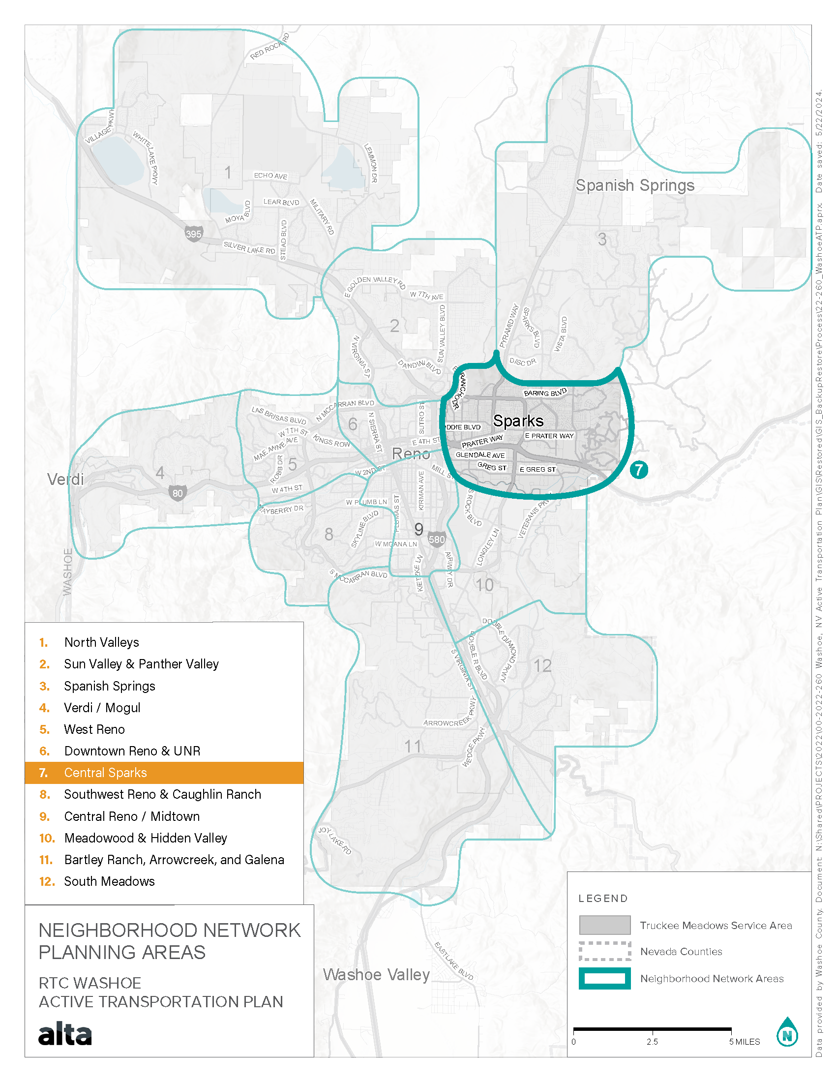
Central Sparks Neighborhood
![]()
THE NEIGHBORHOOD
The Central Sparks neighborhood is the diverse core of Sparks, approximately defined by Baring Boulevard to the north, the Reno-Tahoe International Airport to the south, Teglia’s Paradise Park to the west, and Vista Boulevard to the west.
This diverse region features:
- Victorian Square
- Legends Outlet Mall
- Nugget Casino Resort
- RTC Transit Service, including the Lincoln Line bus rapid transit route.
- Low, medium, and high-density residential communities
- Multiple schools, including both Sparks High School and Reed High School
- Sparks Industrial District
- Public parks
- Various businesses
Central Sparks blends residential living with commercial activity, making it a vibrant and bustling part of the city. Its mix of amenities serves both locals and visitors, highlighting its importance within the broader Sparks community.
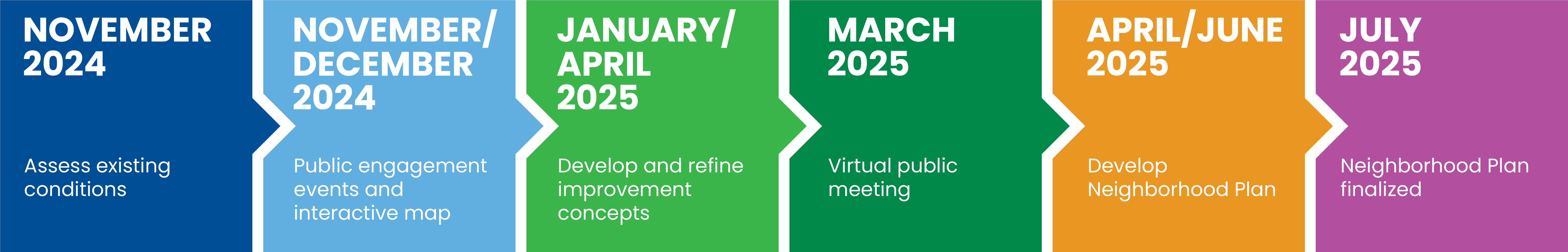
PLAN DEVELOPMENT
To help improve safety and connectivity for people walking, biking, and accessing transit within this neighborhood, as well as enhancing connections to nearby neighborhoods, the Neighborhood Network Planning process for Central Sparks:
- Gathered public input;
- Assessed current conditions;
- Reviewed walking and biking patterns and connectivity to community destinations;
- Created improvement scenarios with project recommendations;
- Identified active transportation needs.
CONTACT
RTC Project Manager (PM)
Marquis Williams, RTC Senior Transportation Planner
mwilliams@rtcwashoe.com