UNIVERSITY GATEWAY TRANSPORTATION PROJECT
Project Overview
| Label | Value |
|---|---|
| Status | Upcoming Projects |
| RTC Project Manager (PM) | Kimberly Diegle, P.E. |
| RTC Engineering Department | (775) 335-1844 |
| Design Firm | To be determined |
| Construction Contractor | To be determined |
Project Description
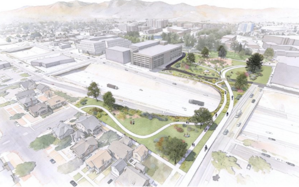
Reconnecting downtown Reno and the University of Nevada
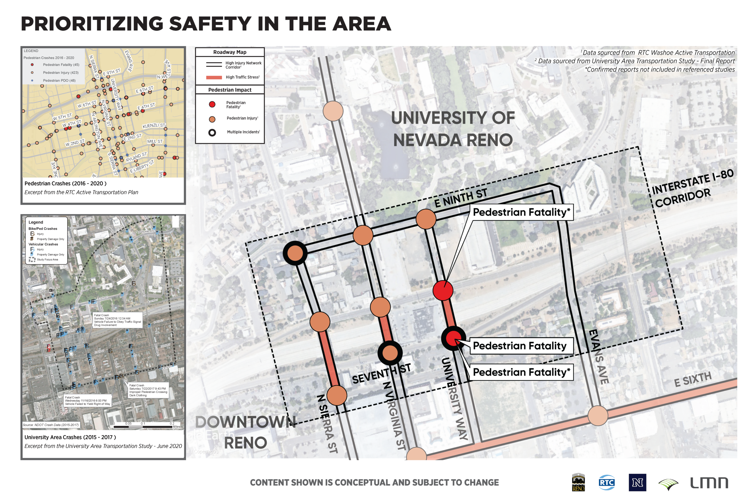
Interstate 80 divided downtown Reno from the University of Nevada, Reno campus more than 50 years ago. Today, pedestrians and cyclists crossing the highway face high-speed traffic, limited visibility and intersections with documented histories of serious and fatal crashes. The University Gateway Transportation Project will change that.
RTC, the City of Reno and the University of Nevada, Reno are partnering to design a safe, accessible and inviting connection across I-80 that links the university campus to downtown, the Riverwalk District, Midtown, and more.
We want to hear from you!
What the project will deliver
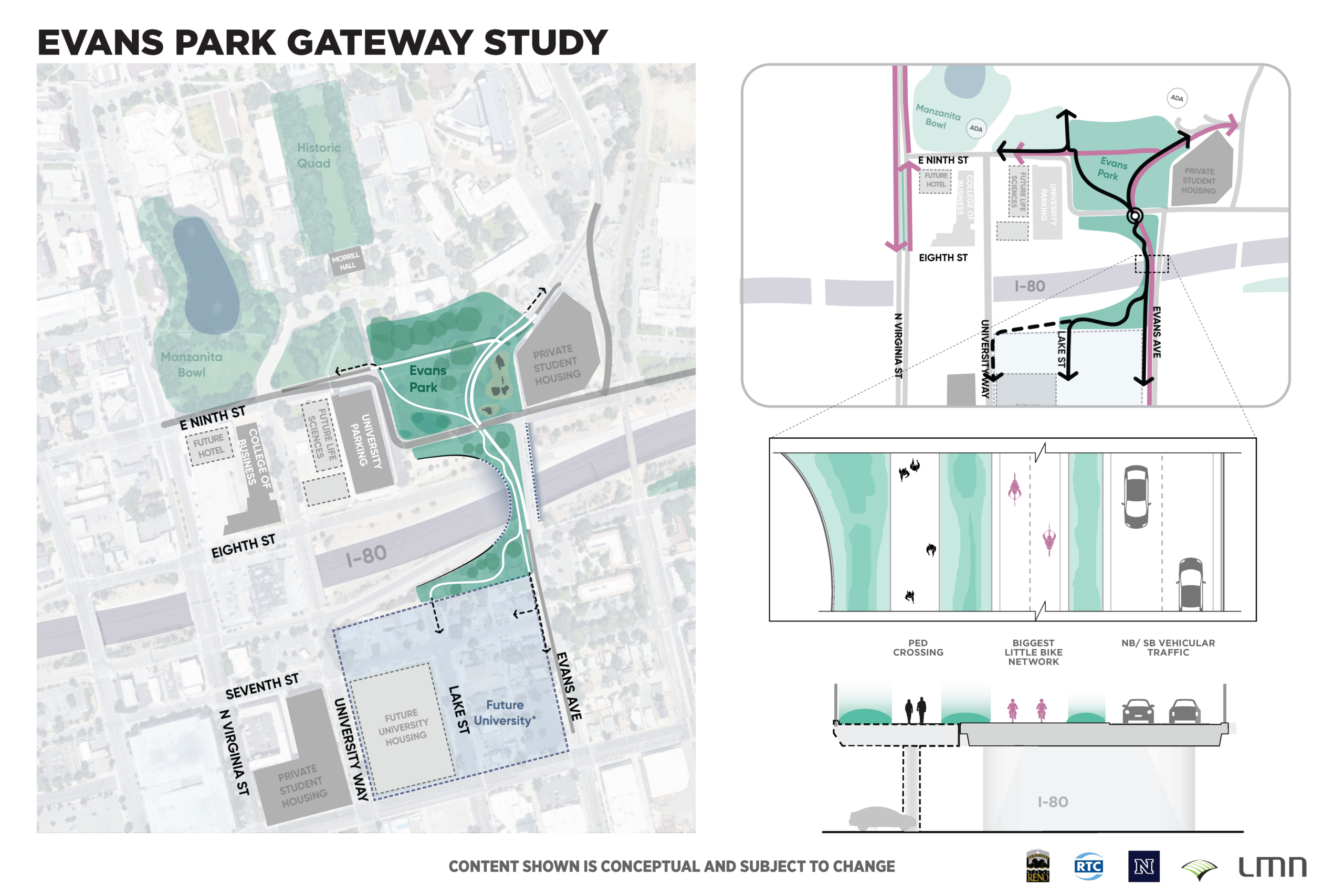
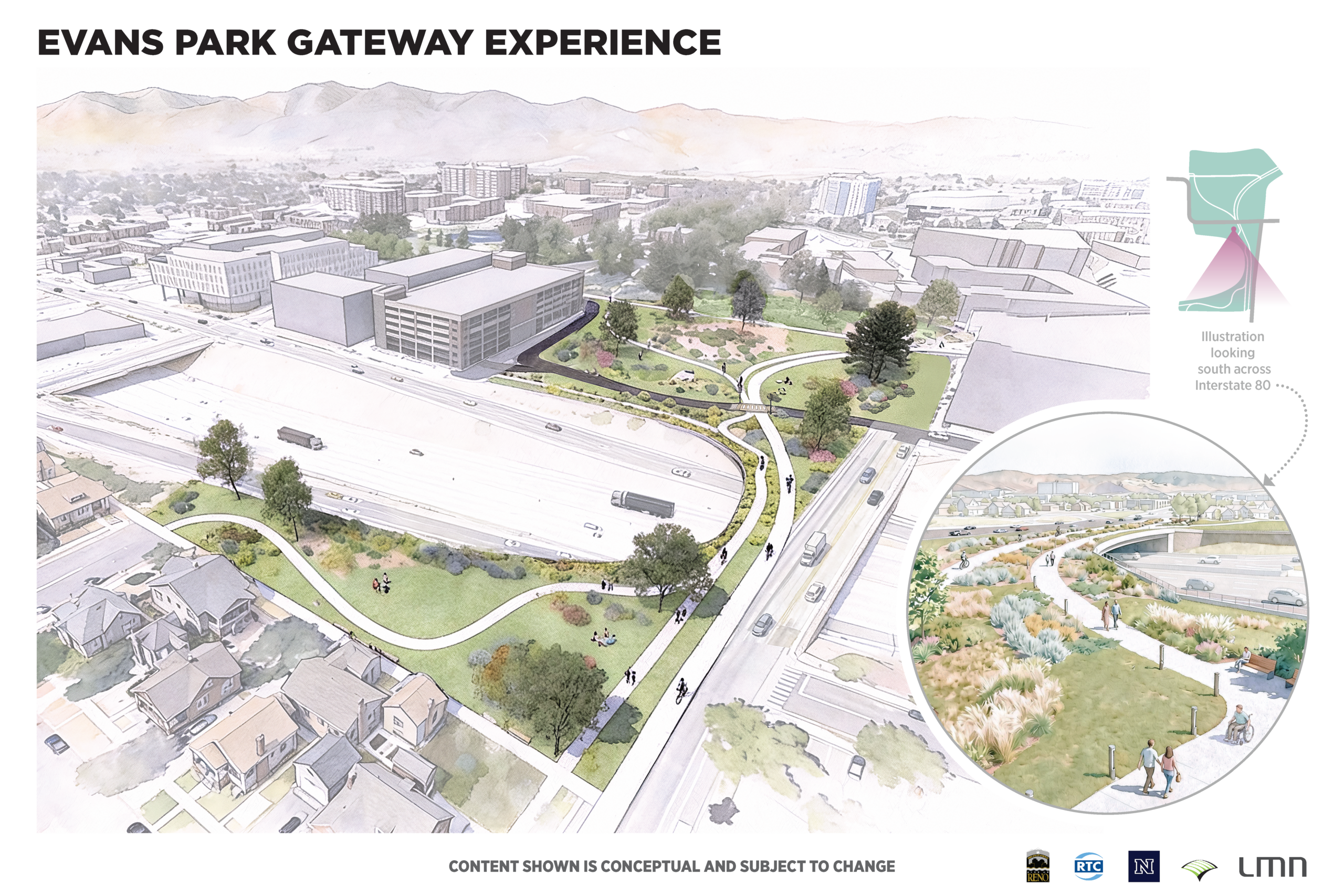
A redesigned Evans Avenue crossing over I-80 with dedicated pedestrian and bicycle infrastructure separated from vehicle traffic. The expanded crossing will include landscape screening, lighting and urban design elements that reduce the visual and physical impact of the highway and extend the character of the university campus south across the interstate.
The project also reimagines Evans Park as a connected campus amenity, integrates with the planned realignment of Ninth Street and creates a visual gateway that serves as the front door to UNR for students, visitors and the community.
Additional transportation improvements include:
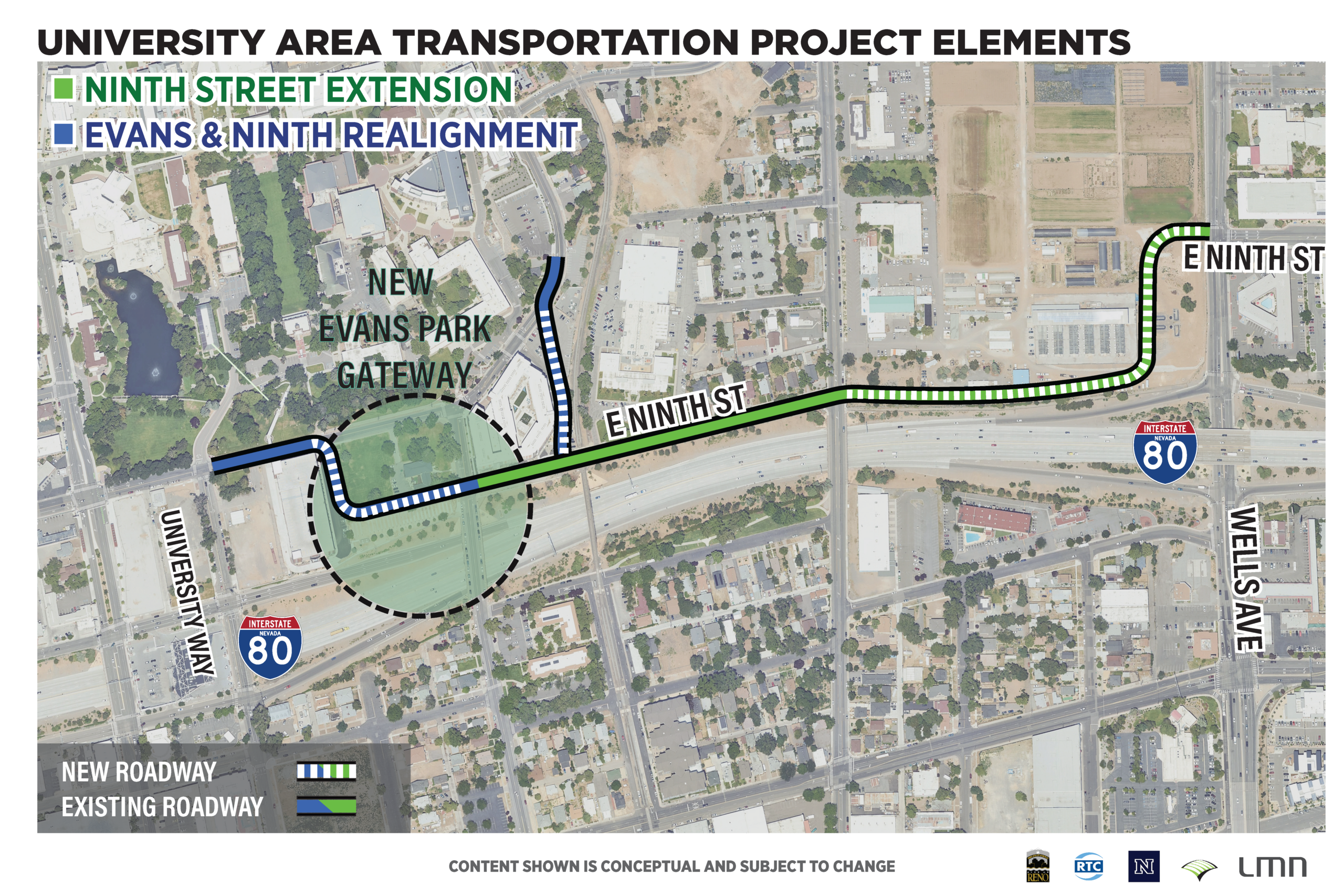
- The extension of East Ninth Street from Valley Road to Wells Avenue, increasing connectivity to the University Gateway area
- Realignment of Ninth Street between University Way and Evans Avenue to the south paired with the re-establishment of Record Street connection to East Ninth St to enhance multi-modal safety in the area
Why this matters
This corridor is on the region’s High Injury Network. Pedestrian fatalities and serious injuries have been documented at multiple locations between Sixth Street and Ninth Street along Virginia Street, University Way and Evans Avenue. Current crossings do not provide adequate safety or comfort for pedestrians and cyclists, and new development on both sides of the highway is increasing the number of people moving through the area.
The project addresses safety while positioning the university district as an economic driver. UNR’s campus is expanding south with planned housing, a life sciences facility, a hotel and a new College of Business building. An enhanced connection across I-80 sets up the next phase of campus growth and strengthens the link between the university and Reno’s commercial core.
Project Partners
The University Gateway Transportation Project is a collaboration between the Regional Transportation Commission of Washoe County, the City of Reno, and the University of Nevada, Reno, Design consultants are Wood Rodgers for the roadway improvements, and LMN Architects for the conceptual development of the Gateway elements. The project is currently in the conceptual design phase.

Latest News
We want to keep the community engaged and informed as the project develops. An initial public meeting is scheduled for May 2026 to share the project vision and conceptual designs with the community and get feedback.
Public Meeting
Date: Wednesday, May 20, 2026
Time: 5 pm – 7 pm, Presentation at 5:30 pm
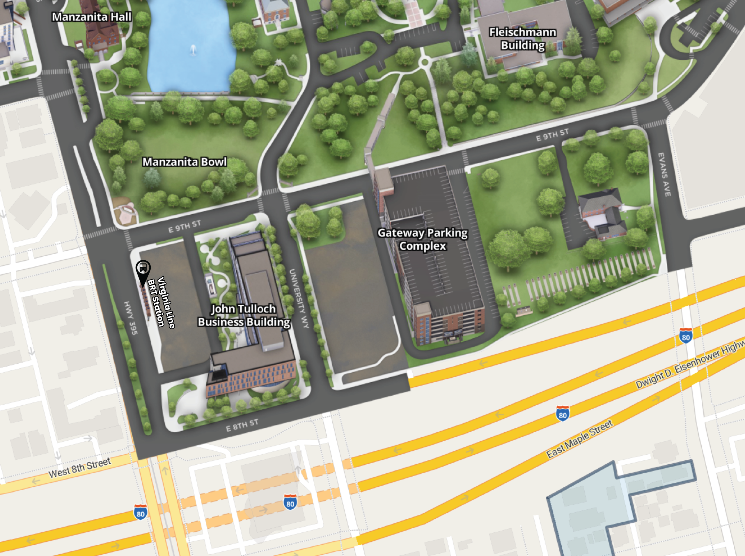
Location: University of Nevada Reno,
John Tulloch Business Building
201 E. 9th Street – Room 100
Meeting Material Presentation Boards: