Central Reno/MidTown Neighborhood Network Plan
The boundaries for the Central Reno/Midtown Neighborhood extend:
- East to Reno-Tahoe International Airport vicinity
- North to Truckee River in Downtown Reno
- South to Just beyond McCarran Boulevard
- West to Washoe County Golf Course area
This expansive district encompasses several notable areas, including:
- MidTown
- Wells Avenue District
- The southern area of Downtown Reno
Central Reno/MidTown is characterized by its rich mix of urban features:
- Low, medium, and high density residential areas;
- Midtown and Wells Districts, vibrant regional commercial destinations;
- Public parks;
- Schools, including Wooster High School;
- Entertainment venues, including the Peppermill and Atlantis Casino Resorts.
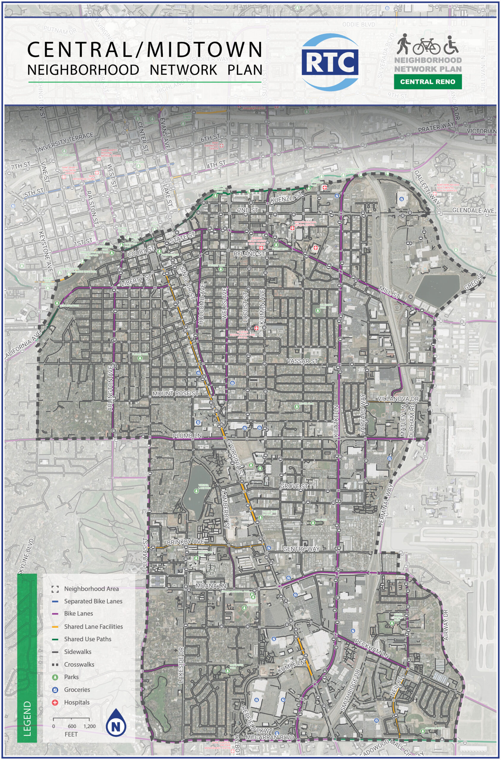
This blend of residential, commercial, and recreational spaces makes Central Reno/Midtown a key hub of activity within the city. Its central location and diverse offerings cater to both residents and visitors, contributing significantly to Reno’s urban fabric and cultural identity.
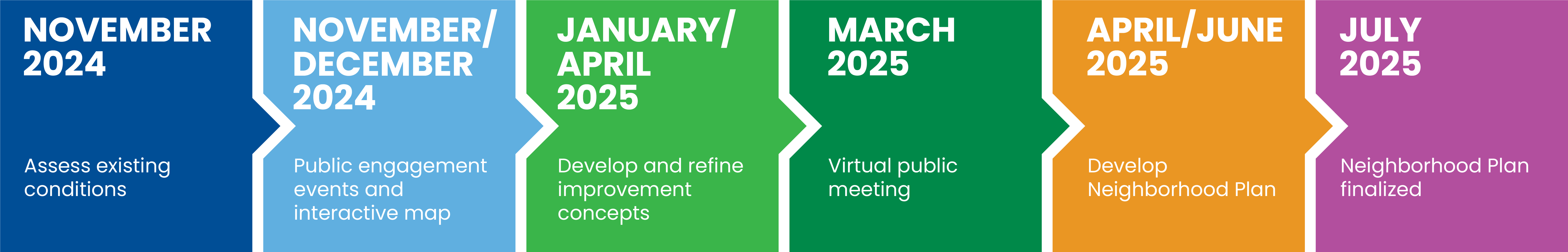
PLAN DEVELOPMENT
To help improve safety and connectivity for people walking, biking, and accessing transit within this neighborhood, as well as enhancing connections to nearby neighborhoods, the Neighborhood Network Planning process for Central/Midtown Reno:
- Gathered public input;
- Assessed current conditions;
- Reviewed walking and biking patterns and connectivity to community destinations;
- Identified active transportation needs;
- Created improvement scenarios with project recommendations;
- Developed a final list of improvements to implement in the next five years
CONTACT
RTC Project Manager (PM)
Marquis Williams, RTC Senior Transportation Planner
mwilliams@rtcwashoe.com