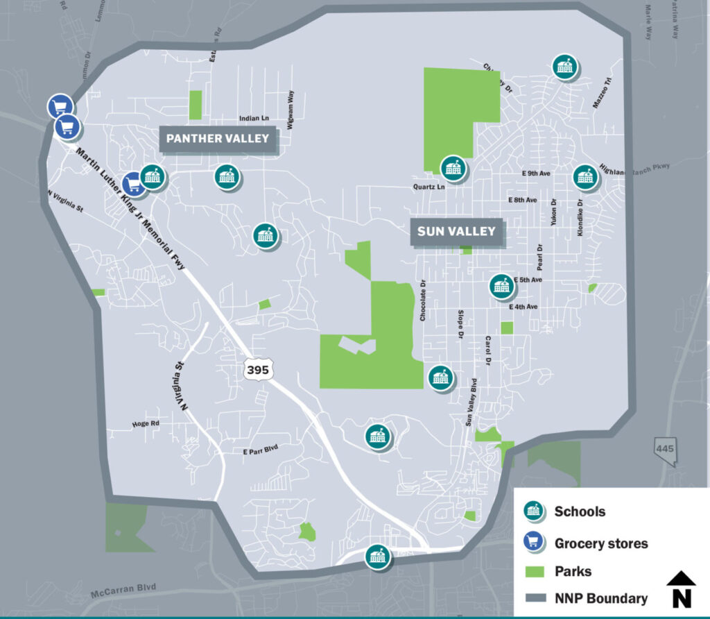
Sun Valley & Panther Valley
THE NEIGHBORHOOD
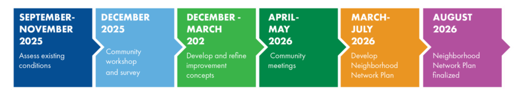
The RTC Active Transportation Program is working with community members to develop Neighborhood Network Plans (NNPs) to make walking, biking, and rolling safer and more comfortable. The NNP will be tailored to the needs of each neighborhood and recommend projects that improve safety and create a comfortable experience for everyone. The Sun Valley & Panther Valley is expected to be completed by summer 2026 and will include recommendations for quickbuild projects that can bring rapid improvements in transportation safety.
Public Outreach
Your feedback is important to us. Help us identify areas of concern and implement effective traffic calming measures that align with your needs and preferences. There are many ways to provide input including:
- Taking the Neighborhood Connectivity Survey (Link below)
- Leaving a comment on the interactive comment map (Link below)
- Send an email to neighborhoodplans@rtcwashoe.com
Sun Valley/Panther Valley Community Workshop
- When: Tuesday, December 9 from 5 p.m. – 6:30 p.m.
- Where: Proctor R. Hug High School (3530 Sullivan Lane, Sparks NV 89431)
Plan Development
To help improve safety and connectivity for people walking, biking, and accessing transit within this neighborhood, as well as enhancing connections to nearby neighborhoods, the Neighborhood Network Planning process for Sun Valley & Panther Valley will:
- Gather public input;
- Assess current conditions;
- Review walking and biking patterns and connectivity to community destinations;
- Create improvement scenarios with project recommendations;
- Identify active transportation needs.
Contact
For questions or comments please email
Neighborhoodplans@rtcwashoe.com