South Meadows
THE NEIGHBORHOOD
RTC invites you to provide feedback on walking and biking in the South Meadows community. We are seeking input for the neighborhood Network Plan (NNP) and looking for opportunities to make active transportation safer and more comfortable for all users.
The NNP planning area includes the Damonte Ranch, Double Diamond, and Virginia Foothills communities. The Plan recommendations will identify improvements to neighborhood streets and crossings, and create connections to community destinations such as Damonte Ranch High School, Depoali Middle School, and Virginia Foothills Park.
The initial outreach for this NNP will run through the end of the year, with a scheduled plan completion date of August 2027. Residents may start to see recommendations from the NNP implemented as soon as 2029.
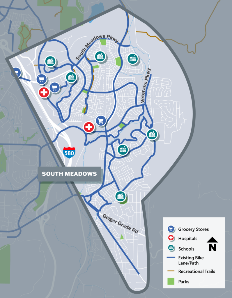
Plan Development
To help improve safety and connectivity for people walking, biking, and accessing transit within this neighborhood, as well as enhancing connections to nearby neighborhoods, the Neighborhood Network Planning process for Northwest Reno will:
- Gather public input;
- Assess current conditions;
- Review walking and biking patterns and connectivity to community destinations;
- Create improvement scenarios with project recommendations;
- Identify active transportation needs.

